
Submissions/OpenStreetMap workshop
|
This is an accepted submission for Wikimania 2015. |
- When & where?
Saturday, July 18 at 15:30 (3:30pm) in Don Americo room.
(see also OpenStreetMap mapping party on Sunday, during lunch)
- Submission no.
- 2101
- Title of the submission
OpenStreetMap workshop
- Type of submission (discussion, hot seat, panel, presentation, tutorial, workshop)
workshop
- Author of the submission
aude
- E-mail address
aude.wiki![]() gmail.com
gmail.com
- Username
aude
- Country of origin
Germany
- Affiliation, if any (organisation, company etc.)
Humanitarian OpenStreetMap Team (HOT)
- Personal homepage or blog
- Abstract (at least 300 words to describe your proposal)
OpenStreetMap is a free and open source, editable mapping project that started in 2004. OpenStreetMap is about much more than mapping streets. A wide range of map features and data are collected, such as those important to cyclists and those needed to support disaster and humanitarian responses. (e.g. the ebola crisis in West Africa in ~2014) The data is open source, under the Open Database License, and can be used to make maps for Wikipedia.
We will begin with a quick introduction to OpenStreetMap, including what the project is about, how to edit and how to collect data. We will do a quick demo of editing using one of the OSM editors (iD or JOSM). We will also cover how to use field papers, which are printed maps that we can take notes on, and an overview of available mobile apps that one can use while out mapping in the field.
For finding things to map beyond one's own city or neighborhood, there is MapRoulette which provides small challenges for fixing issues in OpenStreetMap, such as roads that intersect a building. The HOT tasking manager, usually used to coordinate humanitarian mapping responses, also offers smallish tasks that one can do as a remote mapper. New features of OpenStreetMap include routing (for car, bicycle or walking), which can be useful itself and can also be used to spot errors in the data.
The final part of the workshop will give an overview of tools available (for example, TileMill and Overpass API) to get data out of OpenStreetMap and to make maps, such as for Wikipedia.
In addition, we would like to organize an evening activity following the session for those who want to (optionally) go outside in the local area to collect some map data and add it to OpenStreetMap.
- En español
OpenStreetMap es un proyecto para crear mapas libres y editables que se estableció en 2004. OpenStreetMap incluye mucho mas que calles. Voluntarios recogen datos sobre una variedad de características, incluyendo los que son importantes para los ciclistas y los que son necesarios para ayuda humanitaria. (por ejemplo la epidemia de ébola en África Occidental) Los datos son libres, disponible bajo la licencia abierta Licencia Abierta de Bases de Datos, y pueden ser utilizado para la creación de mapas para Wikipedia.
Vamos a empezar con una introducción breve, incluyendo una explicación que es el proyecto, como editar y levantamiento de información. Vamos a demostrar edición con iD o JOSM, y cubriremos cómo usar una herramienta llamada Field Papers que le permite imprimir mapas para dibujar y añadir notas y después subir a JOSM donde puedes añadir los datos a OpenStreetMap. Tambien vamos a dar una introducción a editar utilizado dispositivos móviles, por ejemplo con Vespucci y OSMAnd, y vamos a demostrar MapRoulette y HOT Tasking Manager para encontrar tareas pequenas. Al final, vamos a dar un resumen de herramientas disponibles para extraer los datos, como TileMill and Overpass API, y hacer mapas.
Ademas, nos quisiera a organizar un "Mapping Party" (osmwiki:ES:Mapping parties) por la tarde, después del taller.
-
 Mapping the National Zoo in Washington, DC (2009)
 -
 OSM mapping party in Haifa, at Wikimania 2011
 -
 OSM mapping party, Wikimania 2012 at Congressional Cemetery
 -
 OSM mapping party and workshop in Kamaishi, Japan (September 2012)
 -
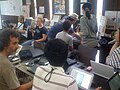
 OSM workshop at Wikimania 2013
 -
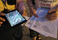 OSM mapping party at Wikimania 2013


- Track
- WikiCulture & Community
- Technology, Interface & Infrastructure
- Length of session (if other than 30 minutes, specify how long)
60 minutes
- Will you attend Wikimania if your submission is not accepted?
Yes, definitely.
- Slides or further information (optional)
I have contributed to OSM since 2008, and has been a member of the Humanitarian OpenStreetMap Team (HOT) since 2011. I co-presented an OSM workshop and organized a mapping party at Wikimania 2011, Wikimania 2012, Wikimania 2013, and at Wiki Conference NYC 2010, and a HOT workshop at Wikimania 2014, along with numerous local events.
Beyond OpenStreetMap, I have contributed to Wikimedia projects for over 10 years, and currently work for Wikimedia Deutschland as a software engineer on the Wikidata project.
I will lead the session, but often other experienced OSM contributors in attendance will assist, particularly with questions, with any hands-on portion (if time allows) and the evening mapping excursion. If needed, I can lead the session on my own.
También puedo hablar español en un nivel medio, pero el taller será principalmente en Inglés.
- Special requests
I would like the session at the end of the day and on a day with no official organized conference activities (e.g. no party), so we can do a mapping party / outdoor mapping afterwards.
Also, please don't schedule same time as key wikidata sessions (especially the WMDE ones), since I should be at those.
Interested attendees
If you are interested in attending this session, please sign with your username below. This will help reviewers to decide which sessions are of high interest. Sign with a hash and four tildes. (# ~~~~).
- Add your username here.
- Rod Wilhelmy @rodowi
Interested in the evening mapping party / outing
- Daniel Mietchen (talk) 12:49, 28 February 2015 (UTC)
- OpenStreetMap is our ONLY friend in mapping! Blue Rasberry (talk) 00:59, 1 March 2015 (UTC)
- Man77 (talk) 21:15, 16 March 2015 (UTC)
- ~~~~
- Rod Wilhelmy @rodowi